Guthook's John Muir Trail Guide is a smartphone guide for your hike on the John Muir Trail. Following on the success of the popular Guthook's Guide series for the Pacific Crest Trail, John Muir Trail Hiker covers the 210.5 mile John Muir Trail from Happy Isles in Yosemite National Park to the summit of Mt. Whitney. It also includes the entire Mt. Whitney Trail (10.4 mile trail from Whitney Portal to Mt. Whitney summit) and side trails to Vermillion Valley Resort (VVR), Red's Meadow and Muir Trail Ranch. The various JMT exit or 'bail-out' side trail junctions are identified as well.
John Muir Trail Hiker use a combination of your phone's GPS, downloaded topo maps, and the Google Maps interface to accurately locate your position on the trail. No phone service? Not a problem -- your phone's GPS pinpoints your location on top of topo maps downloaded as part of the app.
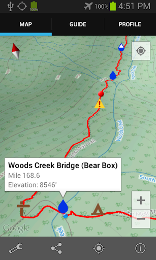
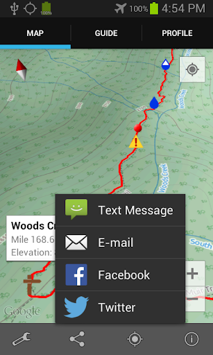
A bright red line indicates the location of the main trail on the map. Side trails are indicated in blue. Waypoints of interest to the hiker are plotted on the map. There are also markers on the map every mile or kilometer of the trail track.
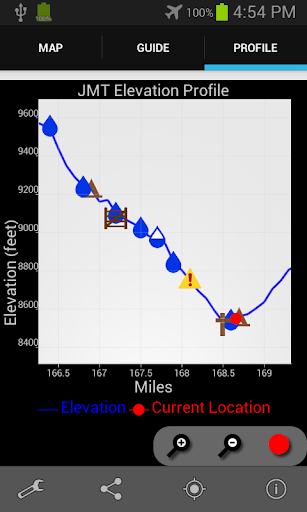
The elevation profile shows trail distance vs elevation and plots your current location on the trail. Each waypoint is plotted on the profile. Each waypoints is clickable, opening to the waypoint's detail page.
The guidebook lists every waypoint in order by distance along the trail.
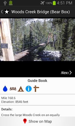
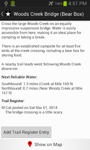
Each waypoint includes a detail page, providing further details about that particular waypoint. Details include the waypoint's mileage point and elevation, photographs of the waypoint, distance northbound and southbound to the next water source, a Trail Register where you may post comments and read other users' comments, and other details that will help you during your hike, and help you plan your hike.
The types of waypoints include:
-->Water sources (including the reliability of each water source)
-->Resupply locations
-->Exit points
-->Tenting sites/camping sites
-->Trail junctions
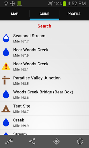
-->Parking areas along the trail
-->Picnic areas, campgrounds, ranger stations
-->Roads,fences, gates
-->Natural landmarks, such as mountain passes and meadows
-->Privies/restrooms
-->Restaurants, stores, lodging
-->Views
About the John Muir Trail: The John Muir Trail, or JMT, is revered as one of the most pristine and beautiful trails in the world. The 210.5 mile trail makes its way through the heart of the Sierra Nevada Range in Central California. Much of the trail is above 10,000 feet elevation and is quite steep, making this a rather difficult trail. Most hikers hike the JMT southbound, beginning at Happy Isles in Yosemite National Park, and ending at the summit of the highest peak in the "lower 48" -- Mt. Whitney. It takes about 2-3 weeks to hike the entire trail (some hikers are faster, some are slower). Many hikers complete the entire trail in one go, and countless others enjoy hiking a few miles along the trail via the many remote side trails that branch off the JMT.
Also available:
Guthook's Guide to the PCT (5-part guide to the Pacific Crest Trail)
Tahoe Rim Trail Hiker
Mt. Whitney Guide
AT Hiker: Guthook's Guide (9-part guide to the Appalachian Trail)
Vermont's Long Trail Hiker
免費玩Guthook's JMT Guide APP玩免費
免費玩Guthook's JMT Guide App
Guthook's JMT Guide APP LOGO

Guthook's JMT Guide APP QRCode
| 熱門國家 | 系統支援 | 版本 | 費用 | APP評分 | 上架日期 | 更新日期 |
|---|---|---|---|---|---|---|
| 未知 | Android Google Play | 3.0.1 App下載 | USD$5.99 | 1970-01-01 | 2015-04-19 |