
Pocket Pole Star is the real time data capture application for Pole Star services.
Use Pocket Pole Star to capture data in the field, on site, in the street or in the office. Collect, edit or delete information using the app. The application can be used to complete examinations, collect asset information, record asset data or to review information. All information is synced with the server to allow one version of information. Multiple users can add data to the same asset.
Pocket Pole Star allows you to record the location of your data with various types of references including: points, lines, polylines and polygons. The GIS data will be automatically geo referenced. Co-ordinates include longitude / latitude and easting / northings.
Pocket Pole Star is a multi discipline data collection and analytical system which allows businesses to collect and store information with a GIS reference. We have combined GIS (geographical information system), CIS (centralized information system), remote monitoring and project management to work as one seamless product. This improves efficiency in both cost and time. In a safety critical environment Pole Star can be used to improve safety.
Pole Star is aimed at varies businesses with small to large asset counts. Business disciplines include: Railways, Highways, Airports, Civil engineering, Oil and gas industry, Mining, Utility companies, Forestry, Agriculture and Farming.
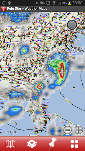
Map View
Toggle between mapping layers to view your GIS data over various digital maps. Default maps are street maps and aerial / satellite images. Upload your own maps using the map tile facility or WMS (web map system) support. Typical available maps include BGS / USGS, Weather charts and Ordnance Survey.
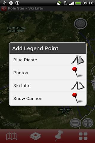
Spatial Data
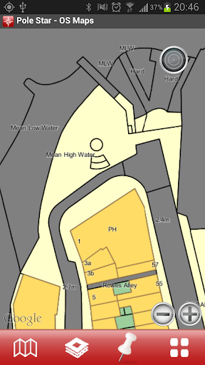
Select the layer(s) of your information you wish to view on the map. You can toggle between single or multiple layers of you information.
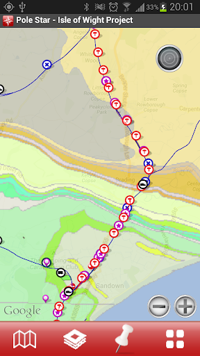
Collect Spatial Information
Drop a location marker to represent the location of the asset. Complete the predefined form and save to capture information. If specified the location, length and area of a marker can be captured automatically.
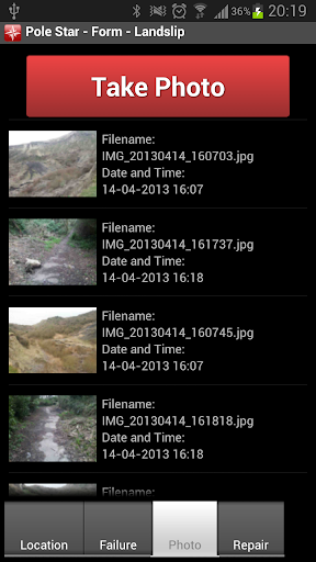
Data
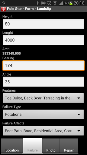
The form is where you add all your information about the chosen spatial layer. Complete the pre-defined form to capture any data you require.
Types of data include: Text, Numbers, Date, Time, Multiple choice, Single choice and Photos.
The forms are designed in the Pole Star application on the website in the form designer page.
Build any form you like and publish it to your phone from your Pole Star domain.
Features
Locate Yourself
Zoom In and Out
Compass

Measure
Add Media
Many Data Capture Options
Upload Markers
Toggle Map Layers
Toggle Spatial Layers

Real Time Data Capture
Share Live Data
We are currently running a free account with a limited access.
免費玩Pole Star Data Capture APP玩免費
免費玩Pole Star Data Capture App
Pole Star Data Capture APP LOGO

Pole Star Data Capture APP QRCode
| 熱門國家 | 系統支援 | 版本 | 費用 | APP評分 | 上架日期 | 更新日期 |
|---|---|---|---|---|---|---|
| 未知 | Android Google Play | 1.10.36.15 App下載 | 免費 | 1970-01-01 | 2015-04-20 |