GPS Plug-in for SuperSurv M3 users.
With this new GPS Plug-in, SuperSurv M3 is now available for user to setup more details with the positioning and data collection progress, and also allow user to connect and control external Bluetooth GNSS devices via SuperSurv M3.
Key Features:
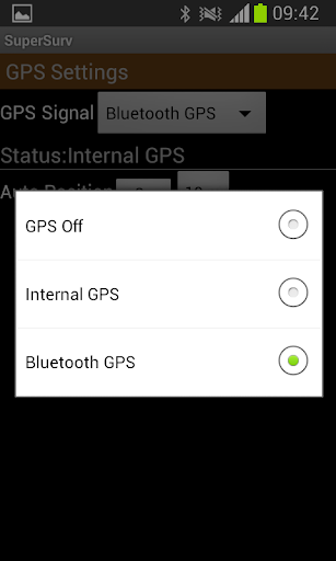
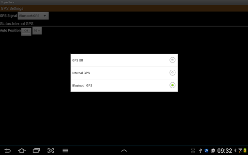
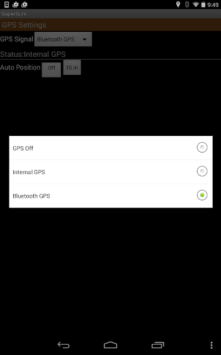
1. Advanced positioning settings.
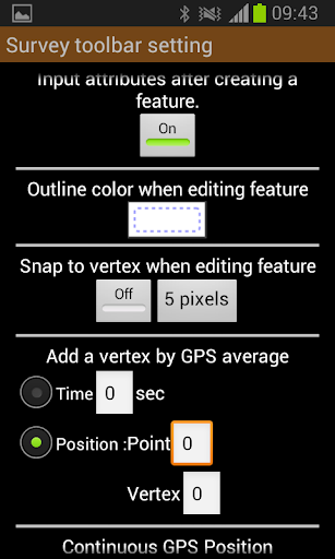
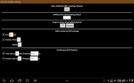
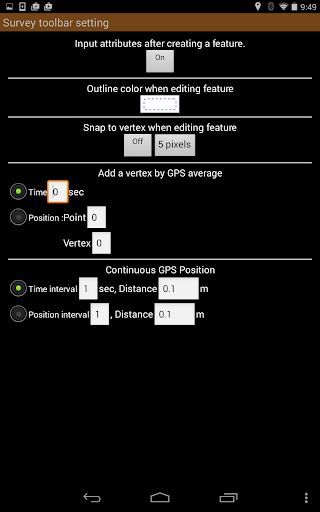
2. More detail options for data collection.
3. Support positioning with external Bluetooth GNSS devices.
Learn more about SuperSurv: http://www.supergeotek.com/productpage_SuperSurv.aspx?Type=Editions
-------------------------------------------------------------------------------------------------------------------------
SuperSurv M3
1st App to edit GIS data in complete off-line mode
1st App to record attributes in custom menu
Save at least 70% of work time than traditional data collection
Visit SuperSurv FB Fan Page for the most updated and exclusive information at https://www.facebook.com/SuperSurv
Key features in SuperSurv M3:
1. Free base maps from OpenStreetMap
2. Geo-tagging to save XY info for surveyed targets
3. On-screen spatial query and measurement tools
4. Various types of point, line and polygon symbols
5. Collect features automatically or manually by real-time GPS
6. Offline data capture & edit (SHP/ GEO)
7. Support global users with local coordinate systems
Integrating with GIS and GPS, SuperSurv M3 is the mobile GIS app for users, no matter an experienced GIS professional or a young surveyor, to easily collect and survey spatial data (including attributes) in the field with Android devices.
The main functions of SuperSurv M3 include data collection, orientation, and map display. With the built-in GPS functions, the data of point, line and polygon can all be captured quickly. Users can apply OpenStreetMap as the basemap to collect spatial data and save the data as SHP/ GEO files.
All the collected data can be exported and applied to desktop GIS applications, like SuperGIS Desktop 3.2 (http://www.supergeotek.com/productpage_SG3.aspx).
Learn more about SuperSurv: http://www.supergeotek.com/productpage_SuperSurv.aspx?Type=Editions
免費玩SuperSurv M3--GPS Plug-in APP玩免費
免費玩SuperSurv M3--GPS Plug-in App
SuperSurv M3--GPS Plug-in APP LOGO

SuperSurv M3--GPS Plug-in APP QRCode
| 熱門國家 | 系統支援 | 版本 | 費用 | APP評分 | 上架日期 | 更新日期 |
|---|---|---|---|---|---|---|
| 未知 | Android Google Play | 3.2.0001 App下載 | TWD$1580.0 | 1970-01-01 | 2015-04-23 |