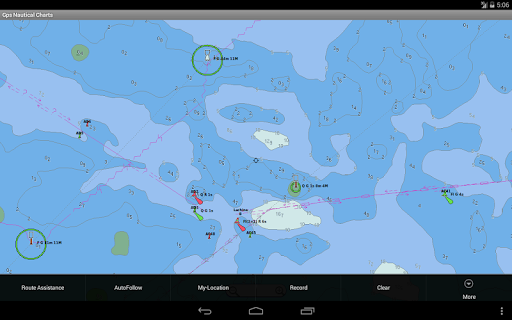
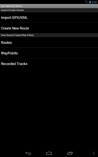
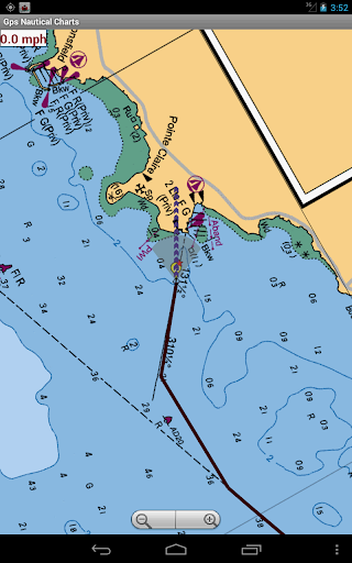
GPS Marine Charts App offers access to RNC charts covering United Kingdom / Ireland waters (derived from UKHO data) with POI layers created from ENC charts. Only marine GPS app to have route assistance with Voice Prompts for marine navigation. It has route manager to create new boating routes or import existing GPX/KML routes. It supports Nautical Charts course up orientation.
Please visit http://www.gpsnauticalcharts.com/main/uk-nautical-charts-by-folio.html for complete list. If you don't find the chart for United Kingdom / Ireland, please contact us at support at gpsnauticalcharts.com.
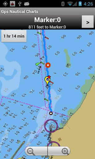
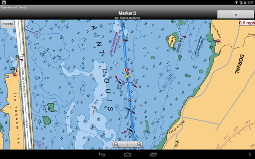
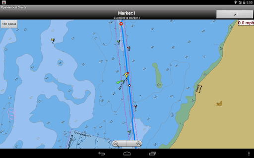
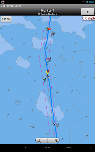
* Voice Prompts for marine navigation (requires GPS )
-prompts when approaching a boating route marker
-Continous distance and ETA updates
-Alerts when sailing/boating off route
-Alerts when boating in wrong direction
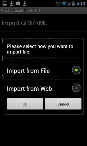
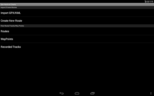
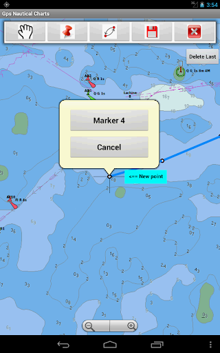
*Route Editing/Creation
-Create routes from scratch
-Edit existing GPX/KML routes.
-Add custom description to any route point.
-Drop markers along route.
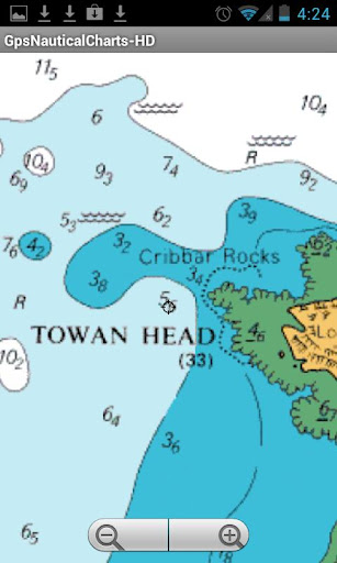
* Offline charts derived from UKHO data.
-Visually draw area to download
-Textual search
-Catalog (By state, region and coast guard district)
-Charts reprojected for WGS84 datum
*Seamless chart quilting of marine charts
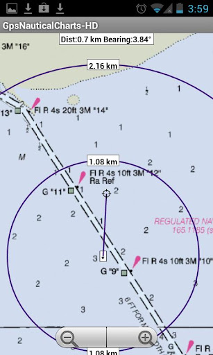
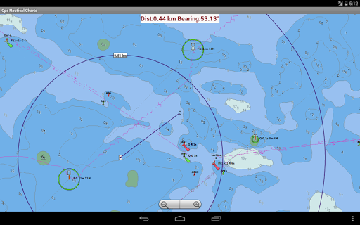
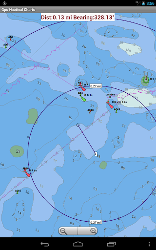
*Distance Bearing tool
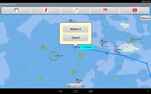
*Create custom way points
- Using GPS
-Select point on map
-Manually enter latitude & longitude coordinates
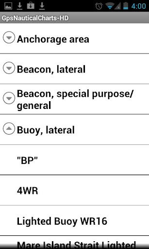
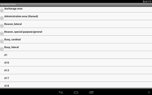
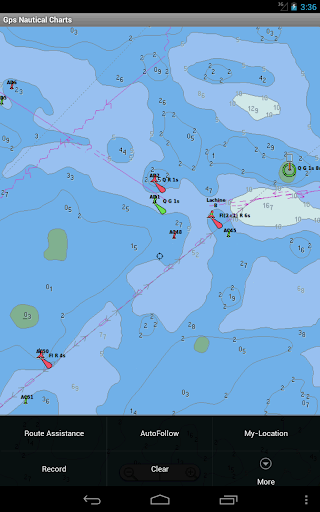
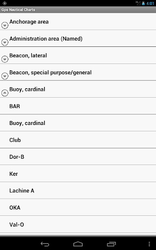
*POI layer for marine charts
- Overlay POIs
- POI list derived from the equivalent ENC and contains all categories including Buoy, Light, Harbour facility, Obstr.
*Search POIs/Way points
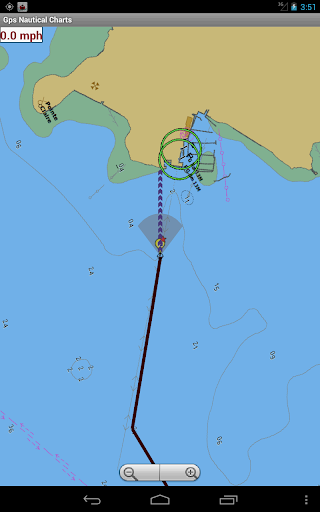
*Pan/Zoom/My Location
* Record Marine GPS tracks
* View tracks overlay
* Live track animation
* Track analytics/stats
* Export GPX tracks.
-Export to SDCard
-Share GPX trakcs with friends/View on Google earth.
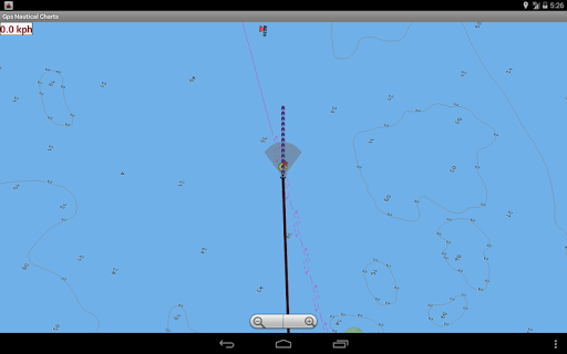
* Auto Follow Mode (Course up)
-Continuously updates boat's location on chart
- Adjustable update frequency
Sample Nautical Charts (please visit http://www.gpsnauticalcharts.com/main/uk-nautical-charts-by-folio.html for complete list)
The Solent and Southampton Water
A Beaulieu River
Western Approaches to The Solent
Approaches to Portsmouth
Bill of Portland to the Needles
Bill of Portland to Anvil Point
Eastern Approaches to the Solent
G Lymington River
A Continuation of River Medina
Southampton Water and Approaches
Outer Approaches to the Solent
Port of Southampton
Selsey Bill to Beachy Head
Approaches to Portland and Weymouth
Cowes Harbour and River Medina
Berry Head to Bill of Portland
A Entrance to River Hamble
Thames Estuary
B River Medina Folly Point to Newport
Portsmouth Harbour
D Ashlett Creek
H Yarmouth Harbour
F Approaches to Keyhaven
C Alum Bay
E Newtown River
Approaches to Felixstowe, Harwich and Ipswich with the Rivers Stour, Orwell and Deben
Falmouth to Plymouth
G Hillhead Harbour
Dartmouth Harbour
Poole Harbour and Approaches
Poole Bay
Falmouth to Truro
B Upper Reaches of Beaulieu River
Continuation of Fareham Lake
I River Yar
H Wootton Creek
Langstone and Chichester Harbours
A Lyme Regis Harbour
A Brighton Marina
Land's End to Falmouth
Portsmouth Harbour Southern Part
E Bembridge Harbour
A Continuation of Holes Bay
Eddystone Rocks to Berry Head
A Approaches to Padstow
Thames Estuary Northern Part
D Freshwater Bay
A Helford River Continuation to Gweek
Tor Bay
Portsmouth Harbour Northern Part
J Lizard Point
Continuation to Port Solent
Start Point to Brixham
A Continuation to Blackness Point
D Newquay Bay
Salcombe to Start Point
A Charlestown Harbour
Portland Harbour
River Thames Sea Reach
A Penzance Bay
Caernarfon Bay
Bristol Channel
B Mevagissey
Linney Head to Oxwich Point
Salcombe Harbour
Harwich and Felixstowe
Salcombe
Approaches to Falmouth
B Par Harbour
免費玩Marine/Nautical Charts-UK/IRL APP玩免費
免費玩Marine/Nautical Charts-UK/IRL App
Marine/Nautical Charts-UK/IRL APP LOGO
Marine/Nautical Charts-UK/IRL APP QRCode
| 熱門國家 | 系統支援 | 版本 | 費用 | APP評分 | 上架日期 | 更新日期 |
|---|---|---|---|---|---|---|
| 未知 | Android Google Play | 43.0 App下載 | USD$24.99 | 1970-01-01 | 2015-04-24 | |
| 台灣 Taiwan | Android Google Play | 42.0 App下載 | NT$749.0 | 2014-07-15 | 2015-03-27 |