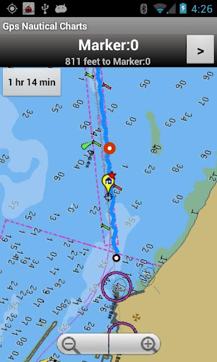
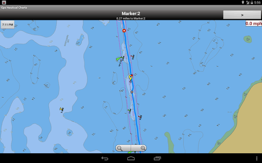
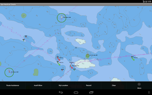
Marine Navigation / Charts App offers access to NOAA & USACE RNC nautical charts with POI data from ENC charts. The app includes 7000+ freshwater lake maps. It supports Marine Charts course up orientation. Includes marine weather data (Tide & Currents data). It has route manager to create new boating routes or import existing GPX/KML routes.
Only marine navigation app to have route assistance with Voice Prompts for marine navigation.
* Voice Prompts for marine navigation / nautical naviagtion (requires GPS )
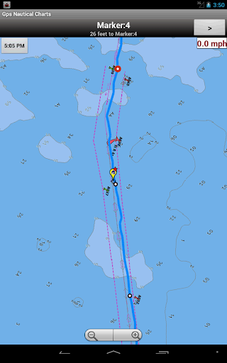
-prompts on approaching a boating route marker
-Continous distance and ETA updates
-Alerts when sailing/boating off route
-Alerts when boating in wrong direction
** Question? pl. contact support at gpsnauticalcharts.com / http://www.gpsnauticalcharts.com **
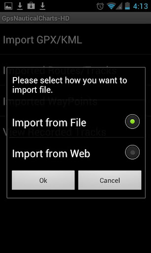
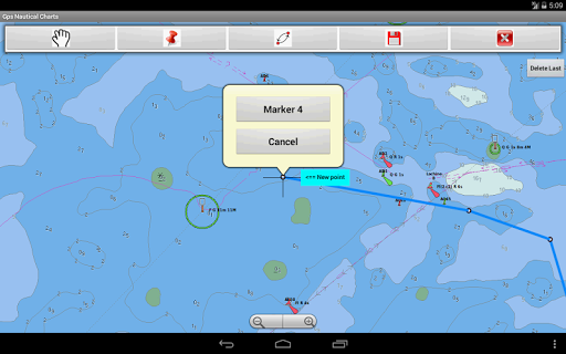
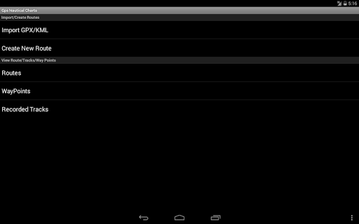
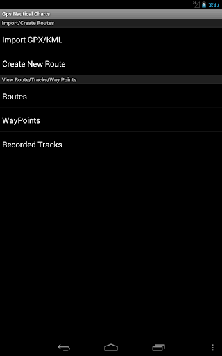
*Route Editing/Creation
-Create routes from scratch
-Edit GPX/KML routes.
-Add custom description to route points.
-Drop markers along route.
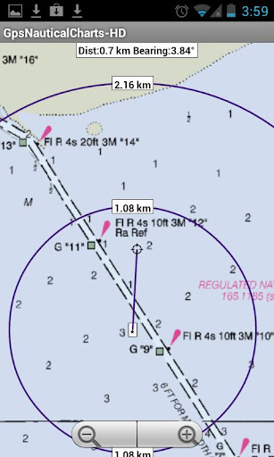
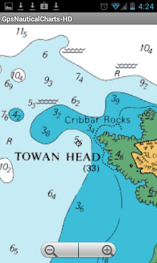
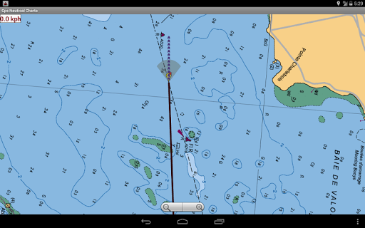
* Offline NOAA charts, USACE rivers, Lake Depth Maps(FreshWater Lakes)
-Visual / Text Search
-Chart Catalog
-Charts reprojected for WGS84 datum
* (NEW)FreshWater Lake maps:
- 7000+ lake depth charts
- Includes boat ramps data
- 1ft / 3ft depth contour maps for anglers for selected lake maps.
- Selected lake maps also contain fishing hot spots.
- Create custom fishing hot spots
* Tide & Currents
-High / Low tides.
-Tidal Currents.
-Active currents stations.
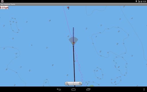
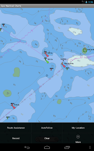
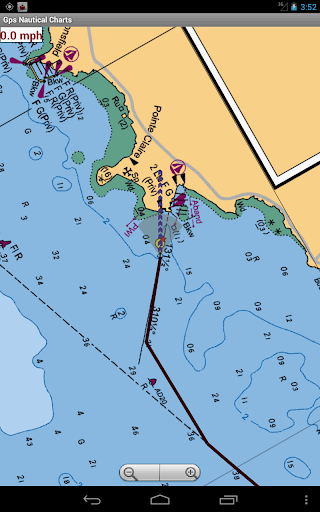
*Seamless chart quilting of marine charts
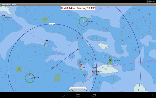
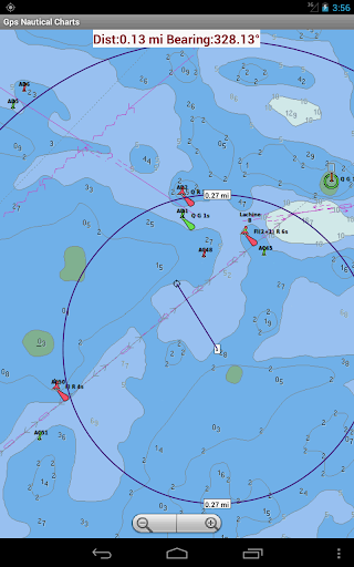
*Distance Bearing tool
*Create custom way points
- Using GPS
-Select point on map
-Manually enter latitude & longitude
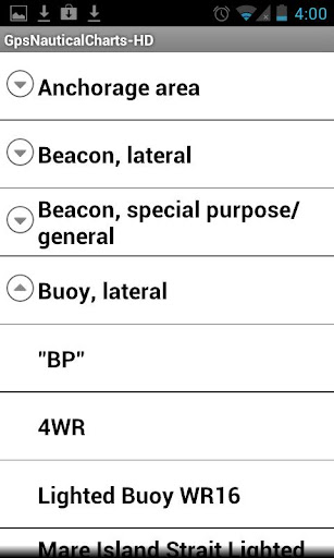
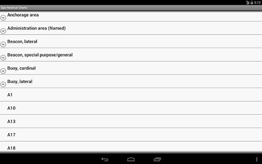
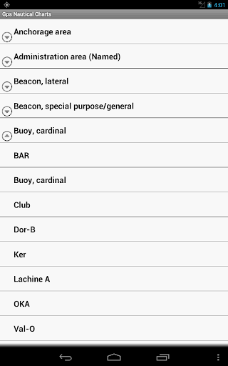
*POI layer for marine charts
- Overlay POIs
- POIs derived from equivalent ENC and contains all categories including Buoy, Light, Harbour facility, Obstr.
*Search POIs/Way points
*Pan/Zoom/My Location
* Record Marine GPS tracks
* View tracks overlay
* Live track animation
* Track analytics/stats
* Export GPX trcks to SDCard
-Share GPX trakcs with friends/View on Google earth.
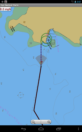
* Auto Follow Mode (Course up)
-Continuously updates boat's location on chart
- Adjustable update frequency
Sample Nautical Charts (see http://gpsnauticalcharts.com/ for all charts)
SUGARLOAF KEY TO KEY WEST
PORT RICHEY TAMPA BAY - CLEARWATER HBR
EAST BAY TO WEST BAY FLORIDA
ST JOSEPH, ST ANDREW BAYS
INTRACOASTAL WATERWAY MATECUMBE TO GRASSY KEY
CHESAPEAKE BAY CAPE CHARLES TO NORFOLK HARBOR
ANCLOTE KEYS TO CRYSTAL RIVER
ST JOSEPH SOUND
MIAMI HARBOR
Minnesota lakes - Kabetogama, Minnetonka, Waconia,Leech,Mille Lacs
Lake Keowee,Jocassee,Hartwell,Greenwood,Lake Murray
Mark Twain,Ozarks,Table Rock
Lake St. Clair
Lake Kentucky
KEY WEST TO THE MISSISSIPPI RIVER
SAN PEDRO CHANNEL
LAKE MICHIGAN STONY LAKE TO POINT BETSIE
APALACHICOLA BAY TO CAPE SAN BLAS
EAST CAPE TO MORMON KEY
CAPE HENLOPEN TO INDIAN RIVER INLET
CHESAPEAKE BAY CAPE HENRY TO THIMBLE SHOAL LIGHT
DULUTH-SUPERIOR HARBOR
MONHEGAN ISLAND TO CAPE ELIZABETH
LAKE ONTARIO - CLAYTON TO FALSE DUCKS ISL
Lake Winnipesaukee
SAN FRANCISCO ENTRANCE
MIAMI TO MARATHON, FLORIDA BAY
CAPE MAY TO FENWICK ISLAND
MISSISSIPPI RIVER TO GALVESTON
CAPE CANAVERAL TO KEY WEST
DELAWARE RIVER WILMINGTON TO PHILADELPHIA
FLORIDA KEYS SOMBRERO KEY TO SAND KEY
SAN PABLO BAY
RAINY LAKE BIG ISLAND MINN TO OAKPOINT ISL ONT
INTRACOASTAL WATERWAY - BISCAYNE BAY
EVERGLADES NTL PARK - SHARK RVR TO LOSTMANS RVR

MIAMI TO MARATHON & FLORIDA BAY
BLACKBURN BAY
LAKE HURON
LAKE TAHOE
STRAITS OF MACKINAC
NORFOLK HARBOR & ELIZABETH RIVER
SAN DIEGO TO SANTA ROSA ISLAND
DELAWARE BAY
CHOPTANK RIVER CAMBRIDGE TO GREENSBORO
FORT LAUDERDALE PORT EVERGLADES
ST SIMONS SOUND TO TOLOMATO RIVER
CHESAPEAKE DELAWARE CANAL
CAPE MENDOCINO
STRAIT OF JUAN DE FUCA ENTRANCE
PORT RICHEY CLEARWATER HBR
PAMPANO BEACH TO HALLADALE FLORIDA
LAKE ERIE
LAKE MICHIGAN INCLUDING GREEN BAY
MAIMI TO MARATHON and FLORIDA BAY
SANTA CATALINA ISLAND
APALACHICOLA BAY TO LAKE WIMICO
免費玩Marine Navigation / Charts USA APP玩免費
免費玩Marine Navigation / Charts USA App
Marine Navigation / Charts USA APP LOGO
Marine Navigation / Charts USA APP QRCode
| 熱門國家 | 系統支援 | 版本 | 費用 | APP評分 | 上架日期 | 更新日期 |
|---|---|---|---|---|---|---|
| 未知 | Android Google Play | 33.0 App下載 | USD$14.99 | 1970-01-01 | 2015-04-21 | |
| 台灣 Taiwan | Android Google Play | 33.0 App下載 | NT$449.0 | 2014-08-23 | 2015-03-27 |