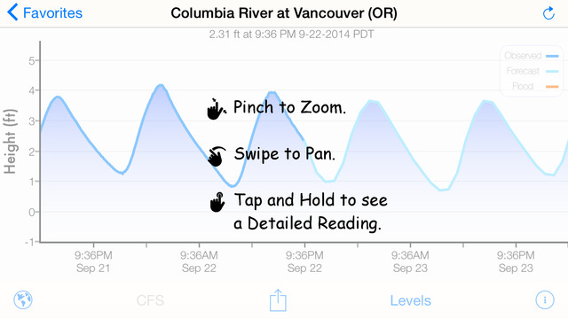
Rivercast’s best-of-class design will help you find the river height or flow information you need quickly. And it's customizable interactive graphs will let you zero in on the forecast or observation times important to you.Rivercast’s Features Include: • Map interface that shows where river gauges are located geographically. • Search interface to find river gauges by waterway name, state, or NOAA 5 digit station ID. • Interactive graphs that you can zoom in, zoom out, or pan. • Customize your graphs by adding river levels that are relevant to you. • Favorites list for locations you care about the most. • Share your graphs via iMessage, Email, Facebook, or Twitter.Rivercast's map not only shows you where the stations are, but usually color codes them to give you an indication whether the location is at normal levels, approaching flood levels, or beyond flood stage.You can get the latest observations from the map, search, or favorites. With an additional tap of your finger you can get a detailed interactive hydrograph. You can zoom in, zoom out, or pan with your fingers to find the exact information you need. If you "tap and hold" on the graph you can view the crosshair "bubble" text to assist you further. To customize your graphs for what's important to you, you can add your own level lines to mark things like sandbars, rocks, bridges, safe conditions, or whatever you would like. And you can add the streams or rivers that you would like to regularly monitor to your Favorites list for easy "at a glance" viewing at any time. Rivercast uses the latest observation and forecast data available, and requires an Internet connection for use. We recommend 3G or better for optimal performance. Hydrograph data is viewable in feet or cfs (if available). Instant Observation data is usually only viewable in feet. All observation and forecast data is in your local time (per your device) for your convenience.A handy tool for boaters, fishermen, property owners, paddlers, hydrologists, and the curious. River gauges reported are USA only.* * * * * * * * * * * * * Please note that there are some gauge locations that you may be able to find online or other mechanisms that are not available via this app. NOAA and other USA government agencies have not yet made all the raw data (required for our custom graphing and mapping solutions) available for all locations. We will add additional gauges if the data becomes available. If you have any questions (or complaints!), please email us.Ad free.
| 熱門國家 | 系統支援 | 版本 | 費用 | APP評分 | 上架日期 | 更新日期 |
|---|---|---|---|---|---|---|
| 未知 | iOS App Store | 3.28 App下載 | 免費 | 2012-11-17 | 2015-06-04 | |
| 美國 (U.S.A) | iOS App Store | 3.13 App下載 | 免費 | 2014-04-25 | 2014-09-21 |


